05::Utils
Introduction
The Utils cluster provides components with miscellaneous functionalities to serve different purposes.
These tools are provided to ease the drawing process for the users.
Component Usage
Please refer to the following sections for each component from this cluster. Some components would require information from component in the Soil.

Bound Morph (Fan)
Radial diagram is a key type of diagram used in soil drawings. It is commonly employed to depict the soil conditions during various times and seasons. In this diagram, instead of using rectangular shapes, the soil triangles must conform to a fan shape. To address this requirement, we develop this component that seamlessly transform the soil diagram from a rectangle into a fan shape, which ensures that the soil triangles precisely fill the fan-shaped regions within the radial diagram.
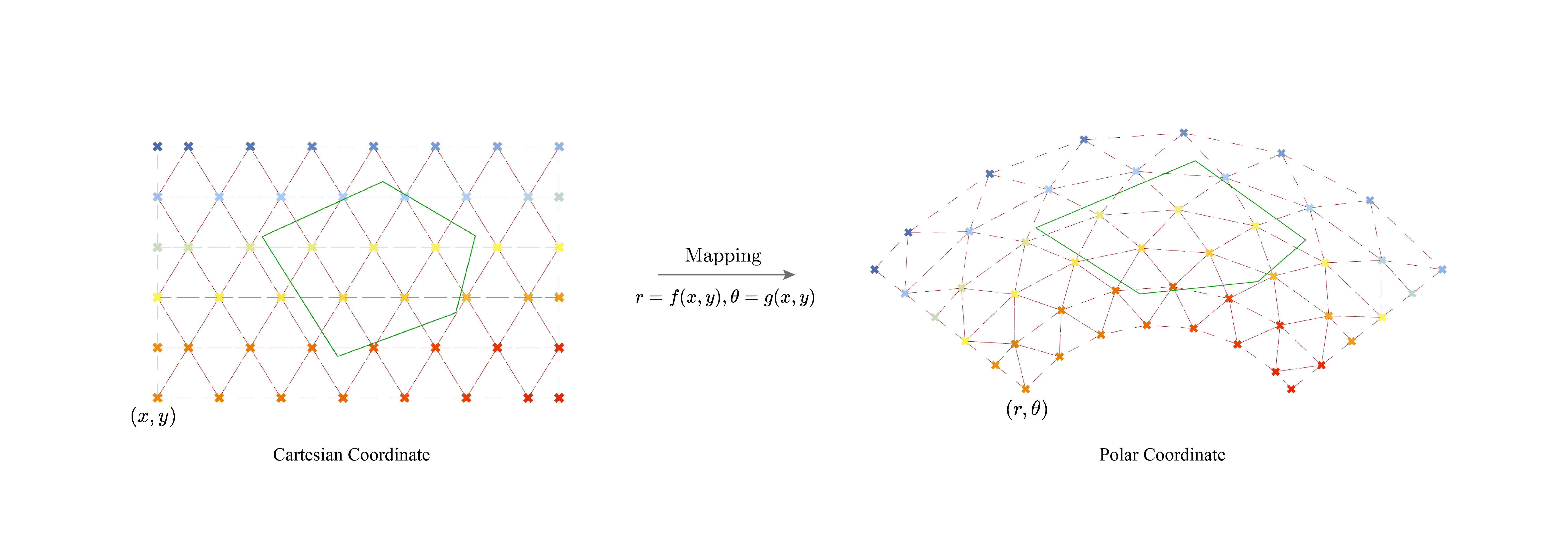
The concept behind morphing involves converting points from Cartesian coordinates (rectangular shape) into points in polar coordinates (fan shape). Consequently, in addition to the defined fan shape, the component requires a rectangular soil base as input. This rectangular soil base serves as the foundation for the transformation process.
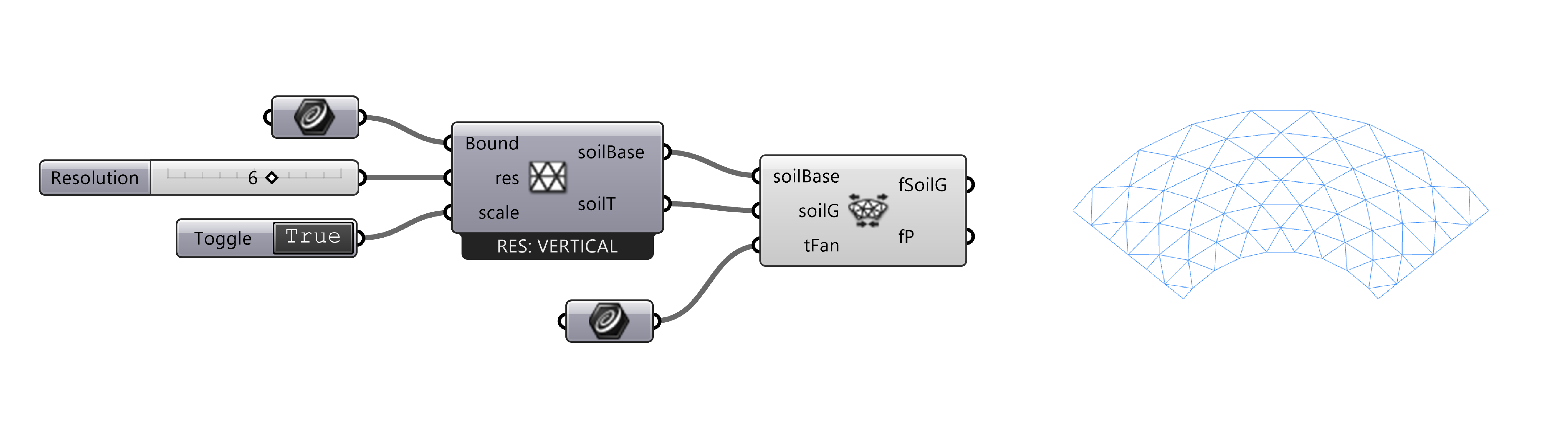
| Parameter | Abbreviation | I/O | Optional | Explanation |
|---|---|---|---|---|
Soil Base |
soilBase |
No | The base object used for soil diagram generation, using output from the Soil Base component. | |
Soil Geo |
soilG |
No | Any line- or polyline-based geometries from the soil system. | |
Target Fan |
tFan |
No | The target closed fan shape curve to morph to. | |
Transformed Geo |
fSoilG |
The morphed soil geometries inside the given fan shape. | ||
Transformed Plane |
fP |
The based plane for the polar coordinate system used during the mapping process. |
- Notes on Fan Shape: The
tFanparameter is designed to receive a perfect and planar fan shape as input. This fan shape should consist of two arcs with the same center point and two lines with equal distances. While the component may not throw an error if different shapes are used, such as arcs with different center points, it will transform the shape into a perfect fan shape, which may result in triangles outside of the intended boundary.
Soil Information
The component exports the soil information in text format.
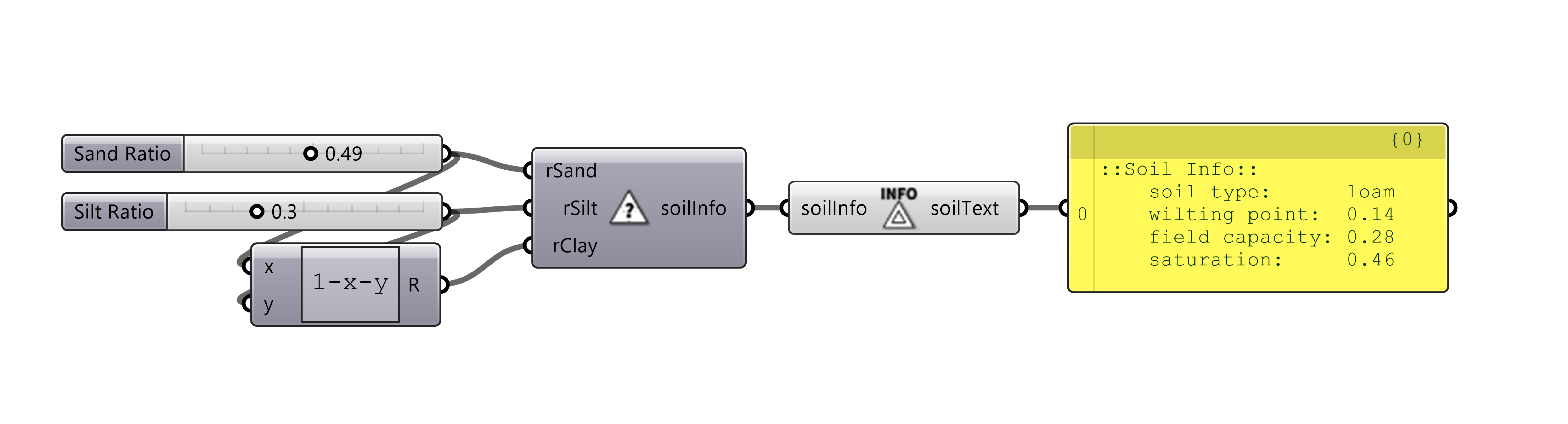
| Parameter | Abbreviation | I/O | Optional | Explanation |
|---|---|---|---|---|
Soil Info |
soilInfo |
No | The soil info, using optput from the Soil Analysis component. | |
Soil Info Text |
soilText |
Soil information in text, can be visualized with the TAG component. |
Demo File
The Utils Demo (.gh file) is a grasshopper file that contains example definitions for the use of Bound Morph component and Soil Info component. Please see the documentation section for more details.